
Hiking with your dog: High Fens and Ardennes, 8 routes
Eight dog-friendly hiking routes in the High Fens and the Ardennes, from Baraque Michel to the Semois, with distance, parking and leash rules.

The Ardennes are one of the few places in Belgium where you can walk for kilometres with your dog without crossing a single road. The region is too large and varied to fit under one label: the peat bog of the High Fens around Botrange, the narrow, fast-flowing stream valleys near Aywaille and Jalhay, the broad meanders of the Ourthe around Hotton and La Roche, and, right down south, the limestone ridges the Semois has carved through the landscape. Each area feels different under your dog’s paws (muddy peat is nothing like a rocky trail above Bouillon) and each area also has its own slightly different rules.
Below are eight routes whose names, municipalities and rules we checked against official tourist offices, nature park managers and hiking platforms, from the flat banks of the Ourthe to the steeper climbs above the Semois. None of these routes is some secret known only to seasoned hikers, they’re waymarked trails you can follow with an ordinary hiking map or a GPX file. What does change from route to route is the distance, the terrain, the amount of shade, and sometimes the exact leash rule. That last point is exactly what you need to watch as an owner, because in the Ardennes “dogs welcome” almost never means “dogs off-leash.”
We deliberately spread these across the three Ardennes provinces (Liège, Luxembourg and Namur) so that wherever you set off from, there’s always a route within a reasonable drive. Five routes lie around the High Fens in Liège province, where peat bog and stream valleys alternate; one route follows the Ourthe in Luxembourg province; and the last two lie in the Semois valley, straddling Luxembourg and Namur.
Before you set off
- Leash requirement. In Walloon forests and nature areas, dogs must be kept on a leash all year round (under the Walloon Forest Code), this isn’t a seasonal rule but a permanent one. A dog off-leash, or dog mess left behind, is the standard trigger for a municipal administrative fine (known locally as a GAS/SAC fine): a sanctioning officer decides case by case, with an amount that typically falls between €50 and €250. In the actual nature reserves, such as the core zones of the High Fens, dogs aren’t allowed in even on a leash. Follow the signs on site, it protects both nature and your dog. More on the rules in can my dog run off-leash here?
- Hunting season. From 1 October to the end of December, sometimes into January, hunting takes place in many Walloon forests, especially during weekend drive hunts. Red-and-yellow signs at access points show where and when a section of forest is temporarily closed. Check them as you go and follow them, even if that means rerouting your walk.
- Water and heat. In summer, always bring enough water, even if the route runs along a river. Riverside paths are great for cooling your dog down, but watch out for strong currents after rain. See also dogs and heat and swimming safely with your dog.
- Ticks. The Ardennes are tick country, especially in tall grass, ferns and peat. Check your dog after every walk, here’s how to spot and safely remove a tick.
- Difficulty level. The distances below are guidelines for an averagely fit dog. Walking with a puppy, an older dog or a flat-faced breed? Choose the shortest variant and build up gradually. See walking with an older dog.
When to go
Every season brings its own thing to watch for with a dog in the Ardennes. In spring, the High Fens peat bog is at its wettest and tick pressure is highest; expect muddy paws and a thorough tick check afterwards. Summer is the busiest period on well-known routes like the Ninglinspo and the Tombeau du Géant, set off early if you want peace and quiet, and plan your walk around the cooler hours, since open stretches like Botrange or Bütgenbach offer little shade. In autumn, the region turns beautiful colours, but that also marks the start of hunting season: watch for the red-and-yellow signs, and if you’d rather be certain, consider a route through a nature reserve, where hunting isn’t allowed. Winter makes boardwalks and rocky stretches (Hoëgne, Hotton, Botassart) slippery. Go for the flatter routes around the lakes of Robertville or Bütgenbach instead.
Around the High Fens (Liège province)
1. The Hoëgne valley
Where: Jalhay – Sart-lez-Spa, Liège province. Distance: a loop of about 9.4 km (+205 m), with shorter variants from 8 km and a long 21 km loop for those who want to make a full day of it. Starting point: the “Au Pont de Belleheid” car park, Roquez 49, Jalhay-Sart. Leash: required.
The trail follows the Hoëgne through a narrow, deeply cut valley, with wooden footbridges over the water and two small waterfalls along the way, the Cascade Marie-Henriette and the Cascade Léopold II. Thanks to the dense tree canopy, it stays fairly cool here even on warm days, and the river itself is shallow enough over long stretches for your dog to simply wade in, without you needing to worry about the current, except after heavy rain. The path itself is a forest trail with roots and loose stones, nothing unusual for a dog, but not a route for a pushchair-style dog trailer. You’ll pass a few picnic tables along the way; in high season, the area around the car park and the first kilometre can get busy with day-trippers, but it quickly thins out further along. The trail is marked with a blue cross. Fancy a terrace after the walk? The spa town of Spa is about ten minutes’ drive further, outside the walk itself, so check beforehand which terraces there welcome dogs.
2. High Fens, Baraque Michel and Mont Rigi
Where: Waimes / Jalhay, High Fens–Eifel Nature Park, Liège province. Distance: a loop of about 7 km around Baraque Michel and Mont Rigi, or a shorter 4 km route (“La Polleur”), flat enough for a pushchair. Starting point: the car park at Baraque Michel or at Mont Rigi. Leash: required across the entire accessible part of the park.
This is the most open landscape on this list: no forest, just heath, peat bog and scattered dwarf birches stretching to the horizon, with wooden boardwalks over the wetter sections. Dogs are welcome across most of the nature park, provided they’re on a leash, the few zones where that’s not allowed are clearly marked on site. In the actual nature reserves, such as the core peat bog between Grand Bongard and Botrange, dogs aren’t allowed in at all, not even on a leash, to protect nesting birds and the fragile sphagnum moss; if you do walk one of the longer boardwalk loops through such a zone, there’s always a detour provided for anyone with a dog. Anyone caught without a leash risks a fine of up to €150. Bring a long line, wear sturdy footwear, the bog is soggy even in summer, and pick up a map beforehand at the Maison du Parc in Botrange or at Baraque Michel: it’s an open, bare landscape without many landmarks, where it’s surprisingly easy to get lost in fog.
3. Ninglinspo
Where: Sedoz – Quarreux, Aywaille municipality, Liège province. Distance: about 6 km, allow around 2.5 hours given the scrambling over boulders. Starting point: the car park in the hamlet of Sedoz (fills up fast on nice days, Nonceveux, Sougné-Remouchamps or Aywaille are good alternatives then). Leash: required.
The trail follows the Ninglinspo stream upstream, weaving between moss-covered boulders and a series of small waterfalls, just technical enough to keep it exciting for anyone who likes hopping across rocks, with plenty of shallow pools your dog will happily dive into. It’s one of the most visited walks in the Ardennes, so expect company at weekends and during holidays; if you’d rather have it quiet, go on a weekday or early in the day. Further on, at the hamlet of Quarreux, the Chefna flows into the Amblève amid a jumble of large boulders (the “Fonds de Quarreux”), a good spot for a break on the flat rocks by the water, popular with swimmers in summer, so keep your dog a bit shorter on the leash among the other water lovers there.
4. Lac de Robertville
Where: Robertville, Waimes municipality, Liège province. Distance: a loop of about 8.9 km around the lake. Difficulty: moderate. Starting point: the car park at the Chalet du Barrage, by the dam. Leash: required on the trail; dogs aren’t allowed on the lake’s designated swimming/beach area, even on a leash.
The route alternates between forest and open shoreline, with a few short climbs away from the water and enough benches for a break along the way. For a dog that loves water, this is mainly a look-and-sniff walk: swimming is only possible outside the supervised, paid swimming zone, and which shoreline sections are accessible beyond that changes by season and water level. Check locally or with the Jalhay-Sart/Robertville-les-Bains tourist office. The reservoir itself is a 19th-century water storage lake with a dam you cross along the way; feel free to combine the walk with a terrace by the water, outside the swimming zone, afterwards. Robertville is within walking distance of Waimes and a fifteen-minute drive from both Bütgenbach and Baraque Michel, making it a handy base if you want to combine several routes from this list in one weekend.
5. Lac de Bütgenbach
Where: Bütgenbach, German-speaking Community, Liège province. Distance: a loop of about 10.2 km, entirely flat. Difficulty: easy, roughly 2.5 hours of walking. Starting point: the car park by the dam, Worriken 9, Bütgenbach. Leash: required.
A sandy path runs the whole way around the lake and is marked with yellow rectangles, you can join it at any point if 10 km is too much for your dog, and with the lake as your landmark, it’s impossible to get lost. Little elevation change, plenty of shade at the forest edge on the less touristy western shore, and on the Worriken side, a busy recreation area with a beach you can walk past with a dog, though not into the water during the supervised swimming season. Of the five routes around the High Fens, this is the flattest and best suited to an older dog or a relaxed morning walk. Bütgenbach lies in the German-speaking Community, which you’ll notice mainly in the signage and place names, the trail markings themselves follow the same system as the rest of Wallonia.
Ourthe and Famenne (Luxembourg province)
6. Hotton on the Ourthe
Where: Hotton, Luxembourg province. Distance: a loop of about 9.2 km, averaging 2h30. Difficulty: fairly demanding, a solid climb out of the valley up to the plateau, and the path is stony and slippery after rain. Starting point: the centre of Hotton, by the Ourthe. Leash: required.
The loop connects the village of Hotton with the Grottoes of Hotton higher up on the plateau: first a climb through forest, then chalk grassland with views over the Ourthe valley, and the descent back through the woods towards Hampteau. The chalk grassland here supports specific, protected plant life, so keep your dog on the path, one more reason to stay on the leash, beyond the legal requirement. Sturdy walking shoes are more than a suggestion here, and for dogs with sensitive paws, this is mainly a route for dry weather: the limestone and tree roots turn slippery as soon as it rains. Lower down, along the Ourthe itself, there are flatter, marshier stretches where dogs can easily get into the water, a welcome cool-down after the climb. If you’d rather have a flat riverside route without the climb up to the grottoes, further along at La Roche-en-Ardenne there are shorter riverside walks of 3 to 10 km, also on-leash.
The Semois valley (Luxembourg and Namur provinces)
The Semois winds all the way from Arlon into France, and the stretch between Bouillon and Vresse-sur-Semois is where the river has cut deepest into the landscape, hence the steep rocky ridges and viewpoints that define this area. The two routes below lie barely 20 kilometres apart, but feel very different because of the terrain and the number of visitors.
7. Tombeau du Géant, Botassart
Where: Botassart, Bouillon municipality, Luxembourg province. Distance: a short loop of about 4 km from Botassart (a longer 14 km variant starts in Bouillon itself). Difficulty: moderate, the descent to the river is pleasant, the way back up has some steep sections. Starting point: the car park just before the start of the walk in Botassart, with a small restaurant for water and toilets. Leash: required, expect crowds at weekends, so keep your dog close at crossings and on the suspension bridge.
The trail descends to a sharp bend in the Semois, with a view over the valley from the “Tombeau du Géant” rock plateau, and crosses the 55-metre suspension bridge “La passerelle du Moulin de l’Epine” along the way. For a dog, the stretch along the river at the bottom is the real draw, shady, with sandy riverbank stretches where they can paddle. This area around Bouillon is one of the busiest hiking destinations in the Ardennes; if you’re going in high season, set off early for a quiet parking spot and fewer people on the suspension bridge.
8. Bohan-Membre Nature Reserve, Vresse-sur-Semois
Where: Bohan – Membre, Vresse-sur-Semois municipality, Namur province. Distance: about 9.5 km, allow 3.5 hours. Difficulty: moderate, with a few short climbs to viewpoints. Starting point: Bohan or Membre-sur-Semois (car park in the village). Leash: required, including inside the nature reserve itself.
The route follows the sharp meanders the Semois has carved into the landscape here, with forest paths along the water and a few open viewpoints high above the river bends. It’s the westernmost (and usually the least busy) of the eight routes here, with the Semois floodplain as its biggest draw: plenty of shade, water within reach at several points along the bank, and noticeably fewer people in summer than at Bouillon or the High Fens. The nature reserve protects the riverbanks and hay meadows, so stay on the path here too; outside the reserve, towards Vresse itself, there are still shorter loops of 5 to 6 km if 9.5 km turns out to be too much for your dog.
Tip: plan your way back before you set off. Dogs are often full of enthusiasm on the way out and tired on the way back, pick a loop that suits your companion’s fitness, and when in doubt, choose the shortest variant of the route.
Maps and GPX
None of the eight routes require specialised hiking gear, a GPX file or an ordinary IGN hiking map (1:25,000 scale) is enough. Most tourist offices in the Ardennes (Aywaille, Bouillon, Waimes, Vresse-sur-Semois, Hotton) sell or hand out free route maps with the local waymarks, blue cross, yellow square, red-and-white GR, and these are more reliable than any random app, especially in the High Fens where signal sometimes drops out. For the High Fens–Eifel Nature Park specifically: pick up a map at the Maison du Parc in Botrange or the Baraque Michel information point before you set off, not along the way. If you’re unsure about a reserve’s current accessibility, or about hunting that weekend, feel free to call the local tourist office, the numbers are on their website.
After the walk
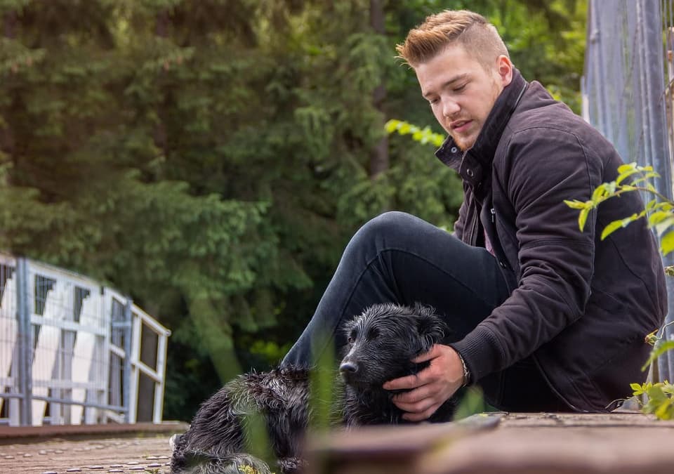 Catching your breath together after a good hike, that’s what it’s really about.
There’s nothing quite like a terrace after a good hike, or a campsite in the area if you’re staying the night.
Got a favourite Ardennes route that’s not on this list? Check out the nature parks on GoPuppy, or add the spot so other owners can discover it too.